Matrix balancing: introduction
Matrix Balancing Models are often used in economic modeling exercises: they create consistent data sets from data originating from different, conflicting data sources. A standard example is updating a matrix subject to given row and column sums. An example can look like:
 |
| Update orange cells subject to row/column sums |
The empty cells are zero, and they should remain zero. In other words, we need to preserve sparsity. Often, we have non-negativity restrictions on the values. The mathematical model can look like this:
| Matrix Balancing Problem |
|---|
| \[\begin{align}\min_{\color{darkred}A}\>&{\bf{dist}}(\color{darkred}A,\color{darkblue}A^0)\\ & \sum_i \color{darkred}A_{i,j} = \color{darkblue}c_j && \forall j\\ & \sum_j \color{darkred}A_{i,j} = \color{darkblue}r_i && \forall i \\&\color{darkred}A_{i,j}=0 &&\forall i,j|\color{darkblue}A^0_{i,j}=0\\ &\color{darkred}A_{i,j}\ge 0 \end{align} \] |
- Cross-entropy:
\(\displaystyle{\min \sum_{i,j} \color{darkred}A_{i,j} \ln \frac{\color{darkred}A_{i,j}}{\color{darkblue}A^0_{i,j}}}\), - Quadratic:
\(\displaystyle{\min \sum_{i,j} \left(\color{darkred}A_{i,j}-\color{darkblue}A^0_{i,j}\right)^2}\), - Relative Quadratic:
\(\displaystyle{\min \sum_{i,j} \left(\frac{\color{darkred}A_{i,j}}{\color{darkblue}A^0_{i,j}}-1\right)^2}\)
Spatial data
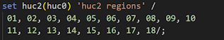
Huc-2 codes can be just 1 digit if the leading 0 is dropped. This depends a bit on the representation: as string or as integer. Integers lose leading zeros. These little details can cause problems when dealing with actual data sets. E.g. the huc-2 codes can look like:
or

It is good to define once and for all how they should look like.
The huc-6 regions are embedded in a huc-4 region, which is again part of a huc-2 region. This forms a hierarchical structure. At the top, we have national data. Often, the national data is considered the bible: we trust those numbers. One reason is that those national numbers are well-known: agricultural economists are very familiar with these statistics.
A beautiful, old-fashioned, retro-style map [1] is:

A more modern, d3-based [2] interactive choropleth map can look like:


Multi-level matrix balancing
The data points (or priors) for each region \(\color{darkblue}a^0_r\) are imprecise. We have a margin of error \(\color{darkblue}E_r\) for each of them. We can use a multi-level matrix balancing model to create a consistent data set. Such a model can look like:
| Multi-level Matrix Balancing Problem |
|---|
| \[\begin{align}\min\>&\sum_{r \in h2\cup h4\cup h6}\color{darkblue}w_r\left(\color{darkred}a_r-\color{darkblue}a^0_r\right)^2\\ & \color{darkred}a_{h4} = \sum_{h6 \in h4} \color{darkred}a_{h6} && \forall h4\\ &\color{darkred}a_{h2} = \sum_{h4 \in h2} \color{darkred}a_{h4} && \forall h2 \\& \color{darkblue}a^0_{\mathit{US}} = \sum_{h2} \color{darkred}a_{h2} \\ &\color{darkred}a_{r}=0 &&\forall r|\color{darkblue}a^0_{r}=0 \\ & \color{darkred}a_{r}\in [\color{darkblue}\ell_r,\color{darkblue}u_r] \\ &\color{darkblue}\ell_r = \max\{\color{darkblue}a^0_r - \color{darkblue}E_r, 0\} \\ & \color{darkblue}u_r = \color{darkblue}a^0_r + \color{darkblue}E_r \\ & \color{darkblue}w_r = \frac{1}{\color{darkblue}u_r-\color{darkblue}\ell_r} \end{align} \] |
- Identifiers colored red are endogenous (decision variables), while the blue symbols are exogenous (parameters).
- The \(r\) index refers to all regions (huc 2, 4, and 6).
- The huc-2 data has to add up to the national level.
- Some variations are possible here, e.g. in how we specify the weights \(\color{darkblue}w_r\) and the functional form of the objective function. In our case, we could use hard bounds based on the margin of error. If that is problematic (too tight), we can use some elastic formulation.
- The real problem is rather large (with many more data for each region). We can solve this in one big model or as a series of smaller models.
- The convex quadratic objective allows us to use a general purpose NLP solver (such as CONOPT), or a more specialized algorithm (such as the conic solver in Cplex).
Conclusions
References
- USGS, Hydrologic Unit Maps, https://water.usgs.gov/GIS/huc.html
- The JavaScript library for bespoke data visualization, https://d3js.org/
Appendix: GAMS code
$onText 3-level matrix balancing demo $offText
*--------------------------------------------------------------- * read sets from huc.inc * the readme part is shown below *---------------------------------------------------------------
*--------------------------------------------------------------- * Regions extracted from c:\tmp\huc\huc6main.geojson * Contents: * set huc0: superset, all huc regions * set huc6: 6 digit huc regions * set huc4: 4 digit huc regions * set huc2: 2 digit huc regions * set hucisin: region 1 is inside region 2 * parameter hucacres: size of region in acres * * Generated: 2023-08-26 *---------------------------------------------------------------
$include c:\tmp\huc\huc.inc
*--------------------------------------------------------------- * generate some dummy data *---------------------------------------------------------------
* shorter names for sets alias(r,huc0); alias(h6,huc6),(h4,huc4),(h2,huc2);
parameter a0(r) 'prior estimates' e(r) 'margin of error' a0us 'national data' ;
a0(h6) = uniform(0,100); e(h6) = uniform(0,100); a0(h4) = sum(hucisin(h6,h4),a0(h6)); e(h4) = uniform(0,50); a0(h2) = sum(hucisin(h4,h2),a0(h4)); e(h2) = uniform(0,20); a0us = sum(h2,a0(h2)) + 100;
*--------------------------------------------------------------- * matrix balancing model *---------------------------------------------------------------
parameters lo(r) 'd-r' up(r) 'd+e' w(r) 'weights' ; lo(r) = max(a0(r)-e(r),0); up(r) = a0(r)+e(r); w(r)$(up(r)>lo(r)) = 1/(up(r)-lo(r));
variable a(r); a.lo(r) = lo(r); a.up(r) = up(r);
variable z 'objective';
equations obj 'minimize squared weighted deviations' sum6(h4) 'h4 = sum h6' sum4(h2) 'h2 = sum h4' sum2 'US = sum h2' ;
obj.. z =e= sum(r, w(r)*sqr(a(r)-a0(r))); sum6(h4).. a(h4) =e= sum(hucisin(h6,h4),a(h6)); sum4(h2).. a(h2) =e= sum(hucisin(h4,h2),a(h4)); sum2.. a0us =e= sum(h2,a(h2));
model matbal /all/; solve matbal using qcp minimizing z; |
No comments:
Post a Comment